Warnings And Advisories Through Tuesday And Bitter Cold Temps This Week
The Winter Weather Advisory and Winter Storm Warning continue for southwest Montana through Tuesday evening, followed by bitter cold temperatures later this week. Details here:
A Winter Storm Warning for elevations above 6000 feet for heavy
snow and blowing snow remains in effect until 11 PM MST Tuesday. A
Winter Weather Advisory for elevations below 6000 feet for a flash
freeze... snow... and blowing snow remains in effect from 11 am
this morning to 11 PM MST Tuesday.
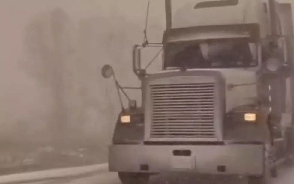
Snow will spread from the mountains into
the valleys today and continue through Tuesday. This will cause
hazardous travel due to snow covered and icy roads.
Snow accumulations: an additional 8 to 14 inches are generally
expected in the mountains and higher valleys. Lower Valley
accumulations will mostly be 2 to 4 inches.
Winds and visibility: gusty west winds will shift to the north
at 15 to 25 mph with gusts to 35 mph by this evening.
Visibilities are expected to be less than a quarter of a mile at
times due to blowing and drifting of snow... causing near
whiteout conditions.
Other impacts: wind chills of 10 degrees below zero to 20
degrees below zero are expected on Tuesday.
Elevations: warning is for elevations above 6000 feet. Advisory
is for elevations below 6000 feet.
Locations affected include: Battle Ridge Pass... Bozeman...
Bozeman Pass... Targhee Pass... West Yellowstone... Boulder...
Boulder Hill... Elk Park Pass... Homestake pass... Whitehall...
Townsend... Big Hole Pass... Chief Joseph Pass... Dillon...
Monida Pass... Ennis... Norris Hill... Raynolds Pass... Twin
Bridges.
More From The Moose 94.7 FM